Hi. We are Love City Strong.
Since 2017, the Love City Strong team has been serving the community of St John in the areas of disaster preparedness, response, recovery, and mitigation. For us, the common thread connecting that work is community resilience. Through unique programs and partnerships in both the public and private sector, we strive to make sure the St John community is growing stronger, more prepared, and more resilient each day. We are excited to share our 2025 Digital Prospectus, an opportunity for us to share our ongoing work in more detail.Our Impact So Far
In the last eight years, some of our team’s achievements on St John include:- Remediating mold in more than 120 homes
- Installing 70 filtration systems, serving 223 people and replacing the consumption of 2,680 plastic water bottles per month
- Conducting bi-annual community needs assessments to help us develop data-driven projects
- Rebuilding 39 homes through our Resilient Housing Initiative
- Retrofitting 16 homes through the FEMA Hazard Mitigation Residential Wind Retrofit Project
- Working with FEMA and VITEMA to pre-stage and manage critical commodities on St John in the event of future disaster impacts
- Hosting the Plan Cruz Bay community charrette, amplifying residents’ vision for the resilient and community-focused future of St John and raising the profile of St John’s needs and priorities in the territory’s Comprehensive Land and Water Use Plan.
2025 Strategic Focus Areas
Disaster Preparedness and Response Love City Strong’s core mission is to build and develop preparedness and response capacity on St John. We base these projects around four pillars: Commodities, Asset, and Facilities Management; Training and Development; Planning and Surge Capacity; and Community Outreach and Education. These strategies have been refined year after year, adjusting and shifting as best practices and industry norms evolve. One of the primary advantages of our community-rooted preparedness and response strategies is that they allow us to manage predictable surge in ways that encourage resilience. Identifying and scoping what constitutes predictable surge in a community, that is, nonprofit and private sector support that is available in the aftermath of a disaster but is not formally contracted, allows public and private entities to work together more efficiently, towards robust and expedient recovery. By cultivating and nurturing our relationships with the private sector, our sister nonprofit organizations, the public sector, and the community at large, we can ensure that all parties are more prepared to respond and address community needs in a timely manner. As we move into 2025, we believe that our hyper-local preparedness capacity building strategies are the most effective path to community resilience. Recovery and Mitigation Recovery is often referred to as “the second disaster”. Historically, recovery lasts years, sometimes decades, and communities in the aftermath of disaster must stay engaged to ensure equitable outcomes. In 2018, Love City Strong expanded our scope to include recovery and mitigation projects. This work includes disaster housing recovery, affordable housing sustainability, project management support, community advocacy, case management, and development of community resources. In line with our mission, we prioritize identifying and addressing unmet needs, either directly, through our programs, or indirectly, by connecting the community to pre-existing or other alternative resources. We advocate for equitable access to recovery resources by St. John families, and work to develop and support sustainable, culturally aligned mitigation strategies, building a stronger, more resilient St. John.Why Your Support Matters
At Love City Strong, we are committed to developing and executing projects that serve and support a more resilient community. Donations allow us to continue repairing homes, developing new programs, preparing for future disasters, and offering training and capacity building opportunities to our team, partners, and the community at large. No gift is too small to make an impact, and we are so grateful for the support that has allowed us to make so much progress to date.- A monthly donation of $10 allows us to provide a preparedness kit for a household in need, supporting their readiness for the upcoming hurricane season.
- A monthly donation of $25 allows us to provide a household in need with two weeks of shelf stable food, for use in a disaster.
- A monthly donation of $100 supports one day of our Go Team’s pre-storm or post-storm Wellness Checks, ensuring that our most vulnerable community members are safe and prepared before and after a storm.
- A one-time gift of $10,000 can provide new metal hurricane shutters for a family home.
Ways to Get Involved
- Direct Donations : Individual gifts help support our work so much! Please donate here if you are able!
- Corporate Partnerships : If your large or small business would like to become a partner of Love City Strong, you can reach out to Meaghan (meaghan@lovecitystrongvi.org) or Mae (mae@lovecitystrongvi.org) to discuss potential partnership opportunities and which of those aligns best with your business’ mission.
- Spreading Awareness : Our donors are our best ambassadors! Please share this post, share our Prospectus, and spread the word about the work that we do.

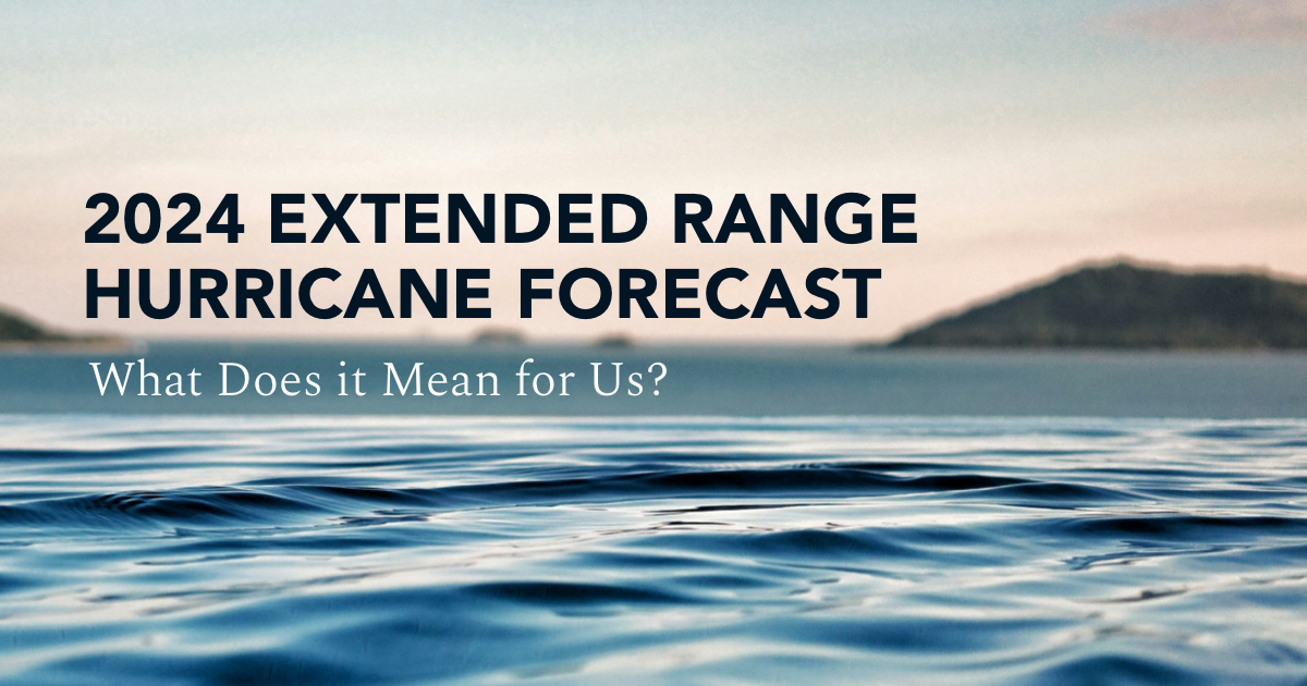
Last week, Colorado State University (CSU) released their initial forecast for the 2025 Atlantic Hurricane Season. The CSU forecast, based on 40 years of past data from four separate models, is calling for activity above the 1991-2020 average during the 2025 season.
What Does That Mean?
Well, due to the current conditions, this initial extended-range forecast estimates that the 2025 season will have 17 named storms, and 4 major hurricanes (Cat 3+). The probability of a major hurricane landfall in the Caribbean or U.S is above average, and the Accumulated Cyclone Energy (ACE) – which is used to measure a named storm’s potential to cause wind damage – is expected to be about 125% of the long-term average.

Why Issue Extended-Range Forecasts for Hurricane Activity?
It is impossible to predict, precisely, this season’s hurricane activity this early in the year. However, it is also useful to examine the current conditions in the Atlantic Basin and the global system to estimate the impact of the coming hurricane seasons. Extended forecasts help us to begin preparing for the 2025 Hurricane Season, and to anticipate what the next few months may hold. The April forecast considers conditions through August 2025, and subsequent forecasts (June 11, July 9, and August 6) will each take the projections further into the season.
Key Takeaways
Most importantly, it only takes one storm to have a major impact, and these forecasts do not predict where particular storms will make landfall. It is best to begin preparations for hurricane season now, no matter what the forecast. It is also important to remember to pay attention to short term forecasts during the hurricane season, as the behavior and impacts of tropical cyclones is evolving. As sea surface temperatures and ocean heat content continue to warm in the next several months, rapid intensification will be a significant concern once again this season. Furthermore, many storms over the past several years have created major rain and flooding events despite being designated “only” a Category 1 hurricane or a Tropical Storm. The speed at which a system is moving and the amount of rainfall it is capable of producing is incredibly important. Rely on the National Weather Service San Juan Office , the National Hurricane Center, and VITEMA for the most up to date information about incoming weather.
Asheville, North Carolina has long been revered for its temperate climate. In the 19th century, its growth was fueled by the theory that it had the climate to cure tuberculosis, and its fresh air and natural beauty have drawn tourists and would be residents ever since. In recent years, climate migration and climate gentrification became increasingly critical conversations as Asheville became touted as a “climate haven”, a city deemed more resilient to climate change, and better able to take in newcomers due to (relatively) affordable housing options and (relatively) forward thinking governance. In 2020, I encouraged my mother to move to Asheville instead of Savannah, or Charleston, on the grounds that it was safer from the impacts of climate change.
The last several days have obliterated any sense of Asheville as a haven from the effects of climate change, and I spent a frantic few days trying to find a way, from the USVI, to help my mother get out of the safe haven I’d recommended. As always, there are lessons to be learned from the devastation. In this case, the growing risks from inland rain events associated with tropical systems, the resulting resource islands and related barriers to recovery, and the importance of cultivating local knowledge and valuing state- and federal-level expertise in emergency management.
Inland Impacts
At 5 pm on September 25th, Hurricane Helene was a Category 1 storm located just north of Cancun, Mexico. A mere 30 hours later, following a period of rapid intensification, Helene made landfall on Thursday evening, September 26th, near Perry, Florida, as a Category 4 storm with winds of 140 mph. The storm then proceeded inland just east of Tallahassee, leaving a trail of destruction north into Georgia, South Carolina, and the southern Appalachian mountains of North Carolina and Tennessee. As of October 1st, there are at least 130 deaths attributed to Helene, and more than 600 people still missing. Asheville sits at 2,000 feet above sea level, nearly 300 miles from the nearest coastline. Nowhere, it would seem, remains safe from the inland impacts of the modern major hurricane.
Inland flooding as a result of tropical cyclones has increasingly become a concern over the past several years. A warmer atmosphere also holds more moisture – approximately 7% more moisture per 1°C of warming. This can help drive rapid intensification, but also means that warmer years are producing wetter storms, driving torrential rain impacts further inland. Over the last year, the National Oceanic and Atmospheric Administration (NOAA) has been rolling out their new “Cone of Concern”, which includes tropical storm and hurricane watches and warnings for inland counties in addition to coastal counties. Additionally, increased outreach regarding the risks of storm surge and flash flooding has been prioritized by federal, state, and local agencies.
In Western North Carolina last week, the region was already experiencing flooding as a result of a front that had stalled. When Helene passed through, more than 20 inches of rain fell on already waterlogged ground, sending the major rivers in the area into extreme flood stage with startling intensity. The Swannanoa River crested at 26.1 feet, more than five feet above the recorded record from 1919. The French Broad River crested at 30.3 feet, exceeding the previous record by more than ten feet. This deluge of water washed out roads across the region, effectively cutting Western North Carolina off from the rest of the world.
Resource Islands
Here in the US Virgin Islands, we are familiar with the logistical challenges of islands. In the seven years since Category 5 Hurricanes Irma and Maria made landfall here within two weeks of each other, Virgin Islanders have navigated an extensive and complex recovery process. Love City Strong’s mission since day one has been to create programs and build capacity in pursuit of a more resilient, sustainable community, to ensure that in future disasters, we understand how to navigate our own recovery.
Over the past few years, we have spoken more and more about how our lessons learned can be applied not only to neighboring Caribbean island communities, but to rural communities anywhere. Many rural communities, whether located in mountainous regions or in the plains of the west, have limited access routes. When these roads are damaged, destroyed, or become inaccessible, these communities face the same challenges as remote Caribbean islands. Relief becomes very difficult to come by, and very expensive to provide. Federal and state resources take time to deploy, and needs assessments take time to complete.
In our experience, these needs assessments are best facilitated by local resources, by neighbors, by mutual aid partners. Familiar faces provide comfort in traumatic times, and response experience nurtured and cached in local communities is a major asset in times of crisis. Increasingly, communities that have never been impacted by a major disaster will find themselves suddenly in the aftermath, with their reality altered in unimaginable ways. In these circumstances, it is critical to have experienced, seasoned professionals at the local, state, and federal levels. Local nonprofits and faith-based organizations know their communities like no one else, and can provide efficient unmet needs assessments at ground level. Emergency management professionals can build local capacity, fill gaps in the response, and help map the path forward to recovery. As we learned firsthand here on St John, it is rarely necessary to reinvent the wheel. Often you just need that wheel schematic, subject matter expertise, and local knowledge to iterate a version that will suit your community’s needs.
Foundations of Experience and Subject Matter Expertise
If there is one resource to prioritize as we look at the future of climate driven disasters, it is experience. At the local level, agencies and organizations have experience advocating for local needs, culture, and priorities. At the state or territorial level, agencies develop capacity, build knowledge, and nurture local talent. At the national level, subject matter experts are building on decades of practical experience and lessons learned, innovating for the future, and lifting up communities experiencing these challenges for the first time. In the past week there’s not a person in the southeast United States who has not been glued to NOAA’s forecasts, or waited for updates on disaster declarations and FEMA deployments.
As the southeast navigates a years-long recovery from the impacts of Helene, each state will benefit from federal support that makes an otherwise inconceivable recovery more navigable. FEMA will provide Individual Assistance, Critical Needs Assistance, Public Assistance, Hazard Mitigation Grants, and more. The Department of Housing and Urban Development (HUD) will provide Community Development Block Grants in both Disaster Recovery and Mitigation tranches. The U.S. Small Business Administration (SBA) will provide disaster loans to help businesses recover, and countless other departments will roll out recovery funding related to their specific mandates.
These financial resources can be, as we’ve learned in the U.S. Virgin Islands in the last seven years, cumbersome to navigate. The subject matter experts at FEMA, HUD, and SBA collaborate with private philanthropy and nonprofit organizations to weave an intricate web of funding sources, technical capacity, and deeply ingrained knowledge that is invaluable to communities facing unprecedented disaster. In a future with climate-driven disasters impacting more areas previously deemed “safe”, our collective focus should be on maintaining and cultivating valuable knowledge, experience, and resources, and integrating them efficiently at the local, state, and federal levels.
On April 4th, the Department of Atmospheric Science at Colorado State University (CSU) released their Extended Range Forecast of Atlantic Seasonal Hurricane Activity and Landfall Strike Probability for 2024. Unsurprisingly, it aligned with other extended range forecasts we’ve already seen this year. CSU is predicting an above average activity level for this Atlantic hurricane season.
The question is, what does this really mean for the USVI, or for any community familiar with the worries of hurricane season?
First, remember that it only takes one storm to turn a quiet season into an active one for any community. All preparations should be made as early as possible, no matter what the extended range forecast looks like.
There are two main factors that are generally considered to be the “engine” of this hurricane season. Number one, the anticipated transition to a La Niña weather pattern. Number two, the unseasonably warm sea surface temperatures in the Atlantic, the Caribbean, and the Gulf of Mexico. The combination of a La Niña, which historically decreases wind shear in the Atlantic Basin, and warmer sea surface temperatures creates a very favorable environment for hurricanes to form. When compared with historical data from similar seasons, this gives the forecasters confidence in their above average extended range forecast.
However, there are many other factors to consider. A strong Saharan Air Layer, for example, helps to inhibit tropical cyclone activity. An active Saharan dust season could change the forecast. Furthermore, it is impossible to predict, in an extended range format, where any given storm is going to make landfall. Specific tracking forecasts are much shorter range. These become more accurate the smaller the window of observation becomes. As hurricane season heats up, it’s important to monitor the five- and three-day forecasts coming out of the National Hurricane Center (NHC).
Finally, and perhaps most importantly, we must remember that the term “category” classifies hurricanes on the Saffir-Simpson scale. When considering the risks associated with a storm, remember the Saffir-Simpson scale considers wind speeds and wind damage, primarily. Assessing risk based on this classification alone discounts hazards associated with heavy rain, storm surge, and slow moving storm systems. These can be just as dangerous as wind, if not more so.
Overall, when dealing with extended range forecasts, use them as general guidance and useful reminders to complete your preparedness activities well in advance of a storm. Make sure you know the most reliable sources of information, like VITEMA, FEMA, NHC, and the National Weather Service (NWS). Learn about the hazards and risks you may face in a storm, and determine the best course of action to keep your household safe. Build or restock your emergency kit. Visit Ready.gov to ensure that you have developed strong emergency preparedness plans with your family, coworkers, and church, and work to build a culture of preparedness in your community. Remember, these forecasts are tools that can help you make strong plans.
2023 Forecast
In April, Colorado State University released their first long range forecast for the 2023 Atlantic Hurricane Season. According to the research team, this season could be slightly below average due to El Niño conditions in the Pacific Ocean. Their projections are for 13 named storms, including 6 hurricanes, 2 of which they expect to be major (Category 3 or higher) storms. These numbers are slightly below the 1991 to 2020 average per year. You may be saying, below average? Great news! However, as we all know, it only takes one storm to create significant damage in our community. Even a below average season can produce above average damage for an island or region. In order to plan proactively and be prepared in the event of a disaster, we must each take a moment to step back and assess our risk, whether at home, at school, at work, or within our communities.What is Risk Assessment?
The United Nations Office for Disaster Risk Reduction defines disaster risk assessment as “a qualitative or quantitative approach to determine the nature and extent of disaster risk by analyzing potential hazards and evaluating existing conditions of exposure and vulnerability that together could harm people, property, services, livelihoods, and the environment on which they depend”. What does that mean for you? Risk assessment on a personal level is the process of taking in all the information you have about a given threat, like a potential hurricane, along with all that you know about your home and your life, and deciding how likely it is that this hazard (the hurricane) will inflict harm. In the context of the 2023 hurricane season forecast, our first inclination might be to feel relief at the prospect of a “slow season”. However, upon examination maybe we remember that we haven’t had the trees on the property trimmed in a while, or that we never did find that one shutter for our bedroom window. Perhaps we recall that our neighbor down the street is still living in a home with a damaged roof, or that a member of our church needs to keep their insulin cold. Understanding the risk for wind damage or for extended power outages can help us to prepare for these needs.Understanding Hazards and Forecasts
We can often become complacent about “small” hurricanes, or “just” tropical storms, but the reality is that these systems are capable of just as much damage. Just last fall, Fiona made landfall in Puerto Rico as a Category 1 storm, but dropped more than 30 inches of rain in two days, triggering catastrophic flooding across the island. We’ve all experienced tropical systems moving through the territory that seem so much more intense than expected, with gusting winds and intense periods of rain. The reality is that these weather patterns are mercurial, subject to change and constant variability. A storm that is headed our way may, to our relief, skirt to our south, and a storm we expected to pass by at a safe distance may make a strong turn and make landfall in the territory. The best course of action is to always be prepared. Internally at Love City Strong, we generally prepare as if a storm will be two categories stronger than forecast. The same approach should be taken for rain forecasts – if we’re expected to get 2 to 4 inches, imagine what the impact would be of 6 to 8 inches, and prepare for that. Over prepared is always best. As we count down until the start of hurricane season on June 1st, it’s important to be proactive and plan ahead. Fire up your generator, check your emergency kit, restock any necessary items. Most importantly, talk about your emergency plans with your family, your neighbors, and your colleagues. The more we normalize conversations about preparedness, the more easily we can support each other in times of crisis.
When it comes to disaster preparedness and management, it is so critical to continue to learn, and to know what’s next. This week, Executive Director Meaghan Enright and Operations Manager Mandy Lemley traveled to New York City to attend the National Disaster and Emergency Management Expo, a conference focused on new trends, products, and strategies in the disaster and emergency management space.
Several seminars were of particular interest, including two presentations by SBP, a nonprofit founded in Louisiana that works in disaster recovery across the country. The SBP presentations, on racial and social equity in disaster and supporting rural communities impacted by disaster, both spoke to the challenges that the U.S. Virgin Islands faces in our recovery.
Another panel of particular interest related to weather forecasting and disasters. Andrew Kruczkiewicz, a Senior Staff Associate at Columbia Climate School International Research Institute for Climate and Society spoke about integrating forecasting into decision making. For example, using seasonal precipitation forecasts to identify regions at higher than average risk of floods, and deploying resources accordingly. This type of forecasting is particularly useful for national and international humanitarian aid organizations, but can also be useful on a smaller scale when it comes to understanding local flash flooding risks.
Another area of interest presented at the conference was the potential applications of machine learning in disaster preparedness and response. For St. John and the greater U.S. Virgin Islands, we are particularly interested in the use of A.I. to expedite preliminary damage assessments in the aftermath of disasters. Expediting the timeline PDAs accelerates distribution of disaster relief funding, and AI technology can also help ensure that damage awards more accurately reflect the cost of reconstruction.
The final session on Thursday, November 17th was titled “The Next Generation : Climate Change and Disaster Management Perspectives”. Sessions like this are great examples of the high level conversations that drive innovation and progress across the industry. As Love City Strong continues to grow and expand our work in disaster preparedness, response, recovery, and mitigation, we need to keep in mind the developing impacts of climate change as well as trends and new approaches within the field. Spending a few days away from the Territory with like-minded disaster management professionals is an excellent opportunity to infuse new ideas and perspectives into our work.
National Preparedness Month is in its final week! This year’s theme is “A Lasting Legacy: The life you’ve built is worth protecting.” All month long we are sharing tips and best practices related to individual, household, and community preparedness. Preparing for disasters is important for you and your family – including your pets!
This week’s topic is: Pet Preparedness
Our pets are family, no doubt about it. It makes sense, therefore, that when we make a plan for the rest of the household, we also plan for our pets. Sheltering, food and water, entertainment, safety… all of these are important considerations for our human AND animal family.
Make a Plan for your Pet
By planning in advance, you can help minimize stress on yourself and your pet. Due to rapidly changing circumstances, you may need to make decisions quickly in an emergency. For example, if you need to go to a shelter, make sure they can accommodate your pet. If they can’t, you’ll need alternate, safe arrangements for them. Most importantly, do not leave your pet behind – they could end up lost, injured, or worse.
- Have an evacuation plan for your pet. In addition to knowing shelter policies, make sure you have the necessary documentation to ensure that your pet can travel with you if needed.
- Plan with neighbors, friends, or family to make sure that someone can take care of your pet if you are unable to do so.
- Get your pet microchipped! Keep your address and phone number up to date and include emergency contact information.
- Food: At least a three-day supply in an airtight, waterproof container.
- Water: At least three days of water specifically for your pets.
- Medicines and medical records: Most boarding kennels, veterinarians and animal shelters will need your pet’s medical records to make sure all vaccinations are current in case of emergency.
- Important documents, for example, registration information, adoption papers and vaccination documents. Talk to your veterinarian about microchipping and enrolling your pet in a recovery database.
- First aid kit, including cotton bandage rolls, bandage tape and scissors, antibiotic ointment, flea and tick prevention, latex gloves, isopropyl alcohol and saline solution. In addition, including a pet first aid reference book is a good idea.
- Collar or harness with ID tag, rabies tag and a leash.
- Crate or pet carrier: Have a sturdy, safe crate or carrier in case you need to evacuate. The carrier should be large enough for your pet to stand, turn around and lie down.
- Sanitation: Pet litter and litter box if appropriate, newspapers, paper towels, plastic trash bags and household chlorine bleach.
- A picture of you and your pet together: If you become separated, a picture of you and your pet together will help you document ownership and allow others to assist you. Add species, breed, age, sex, color and distinguishing characteristics.
- Familiar items such as treats, toys and bedding can help reduce stress for your pet.
As National Hurricane Preparedness Month continues, this week we’re focusing on preparing kids and teens for disaster situations.
Throughout September, we are sharing information about the importance of individual and household preparedness. Not only is this true for adults, but also for the youth in your household and community.
When young people are involved in the preparedness process, it helps to ensure that they feel safe, secure, and comfortable when a disaster strikes. These discussions don’t need to be complicated. First, establish a set time for open, honest dialogue with children and teens to discuss preparedness. Then, talk to them about the different kinds of hazards that could impact your community. Help them understand how the act of preparing beforehand will help keep you and your family safe. Let them ask questions, and do your best to answer them honestly and simply. Finally, as you respond, try to frame your answers in language they will understand, depending on their current stage of development.
Each person in your household should have a role in preparedness. Younger children can collect pre-identified items to go in your household emergency kit. Older children can help do research on potential hazards, or type up your written plan. Teenagers age 14 and up can work with your local emergency response agency to establish a Teen Community Emergency Response Team (CERT) in your community.
Once the kids and teens in your household are involved in your preparedness, encourage them to talk to their friends, classmates, faith leaders, and teachers about their preparedness. Create a strategy for children to share their knowledge and participate in preparedness activities with their peers. This can help normalize the preparedness process in your community.
Don’t wait—Start preparing today! To find more information on how to get children involved in the preparedness process, including interactive games, activities, and videos made especially for children and teens, visit www.ready.gov/kids
For up to date, reliable forecasts, visit the National Hurricane Center website. In the Virgin Islands, specific alerts, watches, and warnings can be found on VITEMA’s website, or sign up for AlertVI.
National Preparedness Month is in full swing! This year’s theme is “A Lasting Legacy: The life you’ve built is worth protecting.” Therefore, throughout September we are sharing tips and best practices related to different aspects of preparedness. Preparing for disasters will help create a lasting legacy for you and your family.
This week’s topic is: Build a Kit.
An emergency kit should include everything that you and your household would need to survive after a disaster. Remember, you may be without electricity, without essential services, and without access to your home for a minimum of seven days.
Non-perishable food, water, medications, first aid supplies, alternative power sources, and copies of your important personal documents are just a few of the essential components that make up a strong emergency kit. You can visit Ready.gov for a comprehensive list of items to keep in your kit.
Every emergency kit is unique. Include the basics needed for survival, as well as items that will make you and your family feel safe and comfortable, both during and after a disaster. This could include toys, a favorite book, a deck of cards, stuffed animals, or a sketchbook or journal. Make sure to include back up glasses or contact lenses, extra batteries for hearing aids, and other items you may need if you’re away from home for an extended period of time.
With COVID-19 still impacting communities around the world, it’s also a good idea to include some extra masks, a digital thermometer, hand sanitizer, and surface cleaning supplies, to help keep your family safe and healthy.
If you have pets, they should have their own emergency kit! Visit the Humane Society’s pet preparedness guide for everything you need to know about creating the best kit for your pets.
It’s never too early to start preparing for a disaster. Evidence shows that those who are prepared with an emergency plan and kit prior to a disaster impact have better outcomes than those who don’t. Building your emergency kits together can help your family address anxieties and fears related to disasters, and offer children in particular a sense of control in unfamiliar circumstances. Start today – build a kit!
National Preparedness Month is in full swing! This year’s theme is “A Lasting Legacy: The life you’ve built is worth protecting.” Therefore, throughout September we are sharing tips and best practices related to individual, household, and community preparedness. Preparing for disasters will help create a lasting legacy for you and your family.
What’s the best place to start preparing? Make a plan!
An emergency plan is a detailed, written set of actions you will take in the event of an emergency. It includes things like where you’ll go if you cannot shelter in place, how you’ll communicate with loved ones both near and far, what your plans are for your pets, and more. For a full description of what to include in your emergency plan, visit Ready.gov/plan
Remember : writing your emergency plan down and discussing it with your family, friends, and neighbors can help manage any fear that exists around potential disasters. Involving kids in the planning process can help ease their anxiety and build confidence as they learn what to do in an emergency.Once you’ve finalized your plan, bring your neighbors and loved ones into the conversation. Sharing your plan saves valuable time for first responders who are checking on people after a disaster. Furthermore, it gives your loved ones peace of mind that you will be safe.
Useful Tip : appoint an out of town friend or family member as your designated point of contact. Put them in charge of reaching out to designated people to let them know that you are safe after a disaster. By notifying your “point of contact” with one call, you save time and resources. This is particularly important if there is prolonged power loss or damage to communication services.Without a doubt, an emergency plan is the foundation for individual and family preparedness. The more prepared that you and your household are, the less reliant on post-disaster services you will need be. As a result, more of your time and energy can be spent helping others, which helps your community recovery in the long run. There’s no better time to start preparing than today! For more information on how to create a written emergency plan, including downloadable plan templates, videos, and activities, visit www.ready.gov/plan. Visit the National Hurricane Center website for up to date, reliable forecasts. Finally, remember to visit VITEMA’s website or sign up for AlertVI to get USVI specific alerts, watches, and warnings.