
In 2025 the US Virgin Islands were blessed with a quiet Atlantic Hurricane Season, though it was not without some close calls. Category 5 Erin brushed the territory in August, and in October we saw our Caribbean neighbors in Jamaica devastated by Category 5 Melissa. These events underscore the importance of preparedness in our communities, not just for hurricanes but for disasters and crises of all kinds. Love City Strong is committed to serving the community of St John in the areas of disaster preparedness, response, recovery, and mitigation, with an emphasis on community resilience. In today’s post, we will briefly recap our work in 2025, and take a look forward at our priorities in 2026.
In 2025, we made progress across all the pillars of our mission.
Disaster Preparedness + Response
- 2025 reinforced the need for community-led preparedness and response capacity as federal emergency management continued to evolve.
- LCS maintains emergency commodities, trains and develops surge capacity with our public and private sector partners, and conducts year round community outreach – these pillars form the backbone of our readiness work.
- We continued our housing recovery work through the FEMA HMGP Wind Retrofit Program and our Resilient Housing Initiative, finishing one complete rebuild and three smaller accessibility projects.
- In partnership with the Caribbean Solar Company, thanks to a grant from Bloomberg Philanthropies, we installed 15 solar and battery back up systems on low- and middle-income homes that have been repaired through our disaster housing recovery programs.
- The Resilient Energy Initiative addresses energy equity head-on, and these families now have reliable power during outages, meaningful relief from high electricity bills, and the capacity to help support their neighbors during disasters.
- Increase our predictable surge capacity by updating our Standby Go Team programming and building a volunteer framework.
- Launch a Community Resilience Mapping Initiative to help increase awareness of and access to resources in a disaster.
- Host workshops on diverse topics including: emergency food + water purification, “Make a Plan,” small business preparedness, boaters’ preparedness, and more.
- Host our regular annual events: the Hurricane Prep Fair, the Prep Fete, and our Community Fun Day, plus weekly LCS Connect pop-ups during hurricane season.
- Continue disaster housing recovery through the FEMA HMGP Wind Retrofit Program and Resilient Housing Initiative
- Complete installation on 15 more Resilient Energy Initiative installations for LMI households and continue fundraising to expand the program.
- Formalize Disaster Case Management guidelines and standard operating procedures in advance of future impacts.
- Build a Bridging Access Initiative and a Community Resource Hub so residents can navigate services more easily.
If you’re interested in supporting Love City Strong’s critical preparedness efforts on St John, please consider becoming a monthly donor! A monthly gift of just $10 can provide a Preparedness Kit to a household in need of assistance.
As we step into 2026, Love City Strong is staying focused on actionable steps that move the needle for St. John: consistent, practical preparedness; stronger local surge capacity; and long-term recovery work that reduces risk for the households most impacted by disasters. We are grateful to the residents who show up and engage in the work of readiness with us, and to the donors, partners, and volunteers who make this hyper-local model possible. Every kit distributed, home strengthened, installation completed, workshop hosted, and plan updated builds a stronger foundation for the next storm and the years beyond. Thank you for being part of this work, and for helping ensure St. John is prepared, supported, and never left behind.
Year-End Update: Resilient Housing Initiative
Recovery is often called “the second disaster” because it lasts long after the wind dies down. On St. John, the housing crisis that followed the 2017 hurricanes has not resolved with time, but rather has grown more serious. Addressing the island’s housing needs has required sustained effort, skilled local labor, patient navigation of complex systems, and consistent community support. That is why Love City Strong launched the Resilient Housing Initiative (RHI) in 2018: to help permanent, full-time St. John residents return to safe, stable homes, rebuilt to be stronger and more disaster resistant than before.What RHI has accomplished (so far)
Since launching RHI, Love City Strong has repaired or rebuilt 40 homes on St. John, with additional small-scope resilience upgrades (like ADA ramps, stairs, and railings) completed through the RHI Minor Works Program at more sites. This work matters because each repaired home:- Brings a neighbor home safely.
- Reduces pressure on a strained long-term rental market.
- Strengthens the island’s ability to withstand future storms.
Where we are right now
The need is still significant. Love City Strong currently has dozens of households in the queue for repairs, spanning a wide range of scopes. In early 2026, we plan to:- Complete the next home in the program (our 41st site), using a BAUHU steel frame kit.
- Begin two full rebuilds using alternative construction methods (BAUHU and Insulated Concrete Form), as part of a broader push to test approaches that may reduce costs over time.
Telling the story, and why it helps
This year, we also worked to improve how we communicate the reality of long-term recovery and what resilience looks like on the ground. We are grateful to have partnered with ElevateWI, a nonprofit based on St. Thomas, USVI, on a video that helps share this story and amplify community-driven solutions.A year-end request: help us keep building
RHI is sustained by people who choose to invest in the work for the long-term. If you believe St. John residents deserve to live in safe, hardened homes, please consider making a year-end gift. Your donation helps fund:- Construction materials and skilled labor.
- Repairs and rebuilds for households with the highest needs.
- The steady project management and casework required to move homes from “in the queue” to “back home.”

Hi. We are Love City Strong.
Since 2017, the Love City Strong team has been serving the community of St John in the areas of disaster preparedness, response, recovery, and mitigation. For us, the common thread connecting that work is community resilience. Through unique programs and partnerships in both the public and private sector, we strive to make sure the St John community is growing stronger, more prepared, and more resilient each day. We are excited to share our 2025 Digital Prospectus, an opportunity for us to share our ongoing work in more detail.Our Impact So Far
In the last eight years, some of our team’s achievements on St John include:- Remediating mold in more than 120 homes
- Installing 70 filtration systems, serving 223 people and replacing the consumption of 2,680 plastic water bottles per month
- Conducting bi-annual community needs assessments to help us develop data-driven projects
- Rebuilding 39 homes through our Resilient Housing Initiative
- Retrofitting 16 homes through the FEMA Hazard Mitigation Residential Wind Retrofit Project
- Working with FEMA and VITEMA to pre-stage and manage critical commodities on St John in the event of future disaster impacts
- Hosting the Plan Cruz Bay community charrette, amplifying residents’ vision for the resilient and community-focused future of St John and raising the profile of St John’s needs and priorities in the territory’s Comprehensive Land and Water Use Plan.
2025 Strategic Focus Areas
Disaster Preparedness and Response Love City Strong’s core mission is to build and develop preparedness and response capacity on St John. We base these projects around four pillars: Commodities, Asset, and Facilities Management; Training and Development; Planning and Surge Capacity; and Community Outreach and Education. These strategies have been refined year after year, adjusting and shifting as best practices and industry norms evolve. One of the primary advantages of our community-rooted preparedness and response strategies is that they allow us to manage predictable surge in ways that encourage resilience. Identifying and scoping what constitutes predictable surge in a community, that is, nonprofit and private sector support that is available in the aftermath of a disaster but is not formally contracted, allows public and private entities to work together more efficiently, towards robust and expedient recovery. By cultivating and nurturing our relationships with the private sector, our sister nonprofit organizations, the public sector, and the community at large, we can ensure that all parties are more prepared to respond and address community needs in a timely manner. As we move into 2025, we believe that our hyper-local preparedness capacity building strategies are the most effective path to community resilience. Recovery and Mitigation Recovery is often referred to as “the second disaster”. Historically, recovery lasts years, sometimes decades, and communities in the aftermath of disaster must stay engaged to ensure equitable outcomes. In 2018, Love City Strong expanded our scope to include recovery and mitigation projects. This work includes disaster housing recovery, affordable housing sustainability, project management support, community advocacy, case management, and development of community resources. In line with our mission, we prioritize identifying and addressing unmet needs, either directly, through our programs, or indirectly, by connecting the community to pre-existing or other alternative resources. We advocate for equitable access to recovery resources by St. John families, and work to develop and support sustainable, culturally aligned mitigation strategies, building a stronger, more resilient St. John.Why Your Support Matters
At Love City Strong, we are committed to developing and executing projects that serve and support a more resilient community. Donations allow us to continue repairing homes, developing new programs, preparing for future disasters, and offering training and capacity building opportunities to our team, partners, and the community at large. No gift is too small to make an impact, and we are so grateful for the support that has allowed us to make so much progress to date.- A monthly donation of $10 allows us to provide a preparedness kit for a household in need, supporting their readiness for the upcoming hurricane season.
- A monthly donation of $25 allows us to provide a household in need with two weeks of shelf stable food, for use in a disaster.
- A monthly donation of $100 supports one day of our Go Team’s pre-storm or post-storm Wellness Checks, ensuring that our most vulnerable community members are safe and prepared before and after a storm.
- A one-time gift of $10,000 can provide new metal hurricane shutters for a family home.
Ways to Get Involved
- Direct Donations : Individual gifts help support our work so much! Please donate here if you are able!
- Corporate Partnerships : If your large or small business would like to become a partner of Love City Strong, you can reach out to Meaghan (meaghan@lovecitystrongvi.org) or Mae (mae@lovecitystrongvi.org) to discuss potential partnership opportunities and which of those aligns best with your business’ mission.
- Spreading Awareness : Our donors are our best ambassadors! Please share this post, share our Prospectus, and spread the word about the work that we do.

Last week, Colorado State University (CSU) released their initial forecast for the 2025 Atlantic Hurricane Season. The CSU forecast, based on 40 years of past data from four separate models, is calling for activity above the 1991-2020 average during the 2025 season.
What Does That Mean?
Well, due to the current conditions, this initial extended-range forecast estimates that the 2025 season will have 17 named storms, and 4 major hurricanes (Cat 3+). The probability of a major hurricane landfall in the Caribbean or U.S is above average, and the Accumulated Cyclone Energy (ACE) – which is used to measure a named storm’s potential to cause wind damage – is expected to be about 125% of the long-term average.

Why Issue Extended-Range Forecasts for Hurricane Activity?
It is impossible to predict, precisely, this season’s hurricane activity this early in the year. However, it is also useful to examine the current conditions in the Atlantic Basin and the global system to estimate the impact of the coming hurricane seasons. Extended forecasts help us to begin preparing for the 2025 Hurricane Season, and to anticipate what the next few months may hold. The April forecast considers conditions through August 2025, and subsequent forecasts (June 11, July 9, and August 6) will each take the projections further into the season.
Key Takeaways
Most importantly, it only takes one storm to have a major impact, and these forecasts do not predict where particular storms will make landfall. It is best to begin preparations for hurricane season now, no matter what the forecast. It is also important to remember to pay attention to short term forecasts during the hurricane season, as the behavior and impacts of tropical cyclones is evolving. As sea surface temperatures and ocean heat content continue to warm in the next several months, rapid intensification will be a significant concern once again this season. Furthermore, many storms over the past several years have created major rain and flooding events despite being designated “only” a Category 1 hurricane or a Tropical Storm. The speed at which a system is moving and the amount of rainfall it is capable of producing is incredibly important. Rely on the National Weather Service San Juan Office , the National Hurricane Center, and VITEMA for the most up to date information about incoming weather.
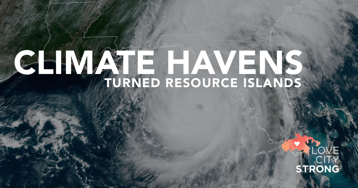
Asheville, North Carolina has long been revered for its temperate climate. In the 19th century, its growth was fueled by the theory that it had the climate to cure tuberculosis, and its fresh air and natural beauty have drawn tourists and would be residents ever since. In recent years, climate migration and climate gentrification became increasingly critical conversations as Asheville became touted as a “climate haven”, a city deemed more resilient to climate change, and better able to take in newcomers due to (relatively) affordable housing options and (relatively) forward thinking governance. In 2020, I encouraged my mother to move to Asheville instead of Savannah, or Charleston, on the grounds that it was safer from the impacts of climate change.
The last several days have obliterated any sense of Asheville as a haven from the effects of climate change, and I spent a frantic few days trying to find a way, from the USVI, to help my mother get out of the safe haven I’d recommended. As always, there are lessons to be learned from the devastation. In this case, the growing risks from inland rain events associated with tropical systems, the resulting resource islands and related barriers to recovery, and the importance of cultivating local knowledge and valuing state- and federal-level expertise in emergency management.
Inland Impacts
At 5 pm on September 25th, Hurricane Helene was a Category 1 storm located just north of Cancun, Mexico. A mere 30 hours later, following a period of rapid intensification, Helene made landfall on Thursday evening, September 26th, near Perry, Florida, as a Category 4 storm with winds of 140 mph. The storm then proceeded inland just east of Tallahassee, leaving a trail of destruction north into Georgia, South Carolina, and the southern Appalachian mountains of North Carolina and Tennessee. As of October 1st, there are at least 130 deaths attributed to Helene, and more than 600 people still missing. Asheville sits at 2,000 feet above sea level, nearly 300 miles from the nearest coastline. Nowhere, it would seem, remains safe from the inland impacts of the modern major hurricane.
Inland flooding as a result of tropical cyclones has increasingly become a concern over the past several years. A warmer atmosphere also holds more moisture – approximately 7% more moisture per 1°C of warming. This can help drive rapid intensification, but also means that warmer years are producing wetter storms, driving torrential rain impacts further inland. Over the last year, the National Oceanic and Atmospheric Administration (NOAA) has been rolling out their new “Cone of Concern”, which includes tropical storm and hurricane watches and warnings for inland counties in addition to coastal counties. Additionally, increased outreach regarding the risks of storm surge and flash flooding has been prioritized by federal, state, and local agencies.
In Western North Carolina last week, the region was already experiencing flooding as a result of a front that had stalled. When Helene passed through, more than 20 inches of rain fell on already waterlogged ground, sending the major rivers in the area into extreme flood stage with startling intensity. The Swannanoa River crested at 26.1 feet, more than five feet above the recorded record from 1919. The French Broad River crested at 30.3 feet, exceeding the previous record by more than ten feet. This deluge of water washed out roads across the region, effectively cutting Western North Carolina off from the rest of the world.
Resource Islands
Here in the US Virgin Islands, we are familiar with the logistical challenges of islands. In the seven years since Category 5 Hurricanes Irma and Maria made landfall here within two weeks of each other, Virgin Islanders have navigated an extensive and complex recovery process. Love City Strong’s mission since day one has been to create programs and build capacity in pursuit of a more resilient, sustainable community, to ensure that in future disasters, we understand how to navigate our own recovery.
Over the past few years, we have spoken more and more about how our lessons learned can be applied not only to neighboring Caribbean island communities, but to rural communities anywhere. Many rural communities, whether located in mountainous regions or in the plains of the west, have limited access routes. When these roads are damaged, destroyed, or become inaccessible, these communities face the same challenges as remote Caribbean islands. Relief becomes very difficult to come by, and very expensive to provide. Federal and state resources take time to deploy, and needs assessments take time to complete.
In our experience, these needs assessments are best facilitated by local resources, by neighbors, by mutual aid partners. Familiar faces provide comfort in traumatic times, and response experience nurtured and cached in local communities is a major asset in times of crisis. Increasingly, communities that have never been impacted by a major disaster will find themselves suddenly in the aftermath, with their reality altered in unimaginable ways. In these circumstances, it is critical to have experienced, seasoned professionals at the local, state, and federal levels. Local nonprofits and faith-based organizations know their communities like no one else, and can provide efficient unmet needs assessments at ground level. Emergency management professionals can build local capacity, fill gaps in the response, and help map the path forward to recovery. As we learned firsthand here on St John, it is rarely necessary to reinvent the wheel. Often you just need that wheel schematic, subject matter expertise, and local knowledge to iterate a version that will suit your community’s needs.
Foundations of Experience and Subject Matter Expertise
If there is one resource to prioritize as we look at the future of climate driven disasters, it is experience. At the local level, agencies and organizations have experience advocating for local needs, culture, and priorities. At the state or territorial level, agencies develop capacity, build knowledge, and nurture local talent. At the national level, subject matter experts are building on decades of practical experience and lessons learned, innovating for the future, and lifting up communities experiencing these challenges for the first time. In the past week there’s not a person in the southeast United States who has not been glued to NOAA’s forecasts, or waited for updates on disaster declarations and FEMA deployments.
As the southeast navigates a years-long recovery from the impacts of Helene, each state will benefit from federal support that makes an otherwise inconceivable recovery more navigable. FEMA will provide Individual Assistance, Critical Needs Assistance, Public Assistance, Hazard Mitigation Grants, and more. The Department of Housing and Urban Development (HUD) will provide Community Development Block Grants in both Disaster Recovery and Mitigation tranches. The U.S. Small Business Administration (SBA) will provide disaster loans to help businesses recover, and countless other departments will roll out recovery funding related to their specific mandates.
These financial resources can be, as we’ve learned in the U.S. Virgin Islands in the last seven years, cumbersome to navigate. The subject matter experts at FEMA, HUD, and SBA collaborate with private philanthropy and nonprofit organizations to weave an intricate web of funding sources, technical capacity, and deeply ingrained knowledge that is invaluable to communities facing unprecedented disaster. In a future with climate-driven disasters impacting more areas previously deemed “safe”, our collective focus should be on maintaining and cultivating valuable knowledge, experience, and resources, and integrating them efficiently at the local, state, and federal levels.
On April 4th, the Department of Atmospheric Science at Colorado State University (CSU) released their Extended Range Forecast of Atlantic Seasonal Hurricane Activity and Landfall Strike Probability for 2024. Unsurprisingly, it aligned with other extended range forecasts we’ve already seen this year. CSU is predicting an above average activity level for this Atlantic hurricane season.
The question is, what does this really mean for the USVI, or for any community familiar with the worries of hurricane season?
First, remember that it only takes one storm to turn a quiet season into an active one for any community. All preparations should be made as early as possible, no matter what the extended range forecast looks like.
There are two main factors that are generally considered to be the “engine” of this hurricane season. Number one, the anticipated transition to a La Niña weather pattern. Number two, the unseasonably warm sea surface temperatures in the Atlantic, the Caribbean, and the Gulf of Mexico. The combination of a La Niña, which historically decreases wind shear in the Atlantic Basin, and warmer sea surface temperatures creates a very favorable environment for hurricanes to form. When compared with historical data from similar seasons, this gives the forecasters confidence in their above average extended range forecast.
However, there are many other factors to consider. A strong Saharan Air Layer, for example, helps to inhibit tropical cyclone activity. An active Saharan dust season could change the forecast. Furthermore, it is impossible to predict, in an extended range format, where any given storm is going to make landfall. Specific tracking forecasts are much shorter range. These become more accurate the smaller the window of observation becomes. As hurricane season heats up, it’s important to monitor the five- and three-day forecasts coming out of the National Hurricane Center (NHC).
Finally, and perhaps most importantly, we must remember that the term “category” classifies hurricanes on the Saffir-Simpson scale. When considering the risks associated with a storm, remember the Saffir-Simpson scale considers wind speeds and wind damage, primarily. Assessing risk based on this classification alone discounts hazards associated with heavy rain, storm surge, and slow moving storm systems. These can be just as dangerous as wind, if not more so.
Overall, when dealing with extended range forecasts, use them as general guidance and useful reminders to complete your preparedness activities well in advance of a storm. Make sure you know the most reliable sources of information, like VITEMA, FEMA, NHC, and the National Weather Service (NWS). Learn about the hazards and risks you may face in a storm, and determine the best course of action to keep your household safe. Build or restock your emergency kit. Visit Ready.gov to ensure that you have developed strong emergency preparedness plans with your family, coworkers, and church, and work to build a culture of preparedness in your community. Remember, these forecasts are tools that can help you make strong plans.
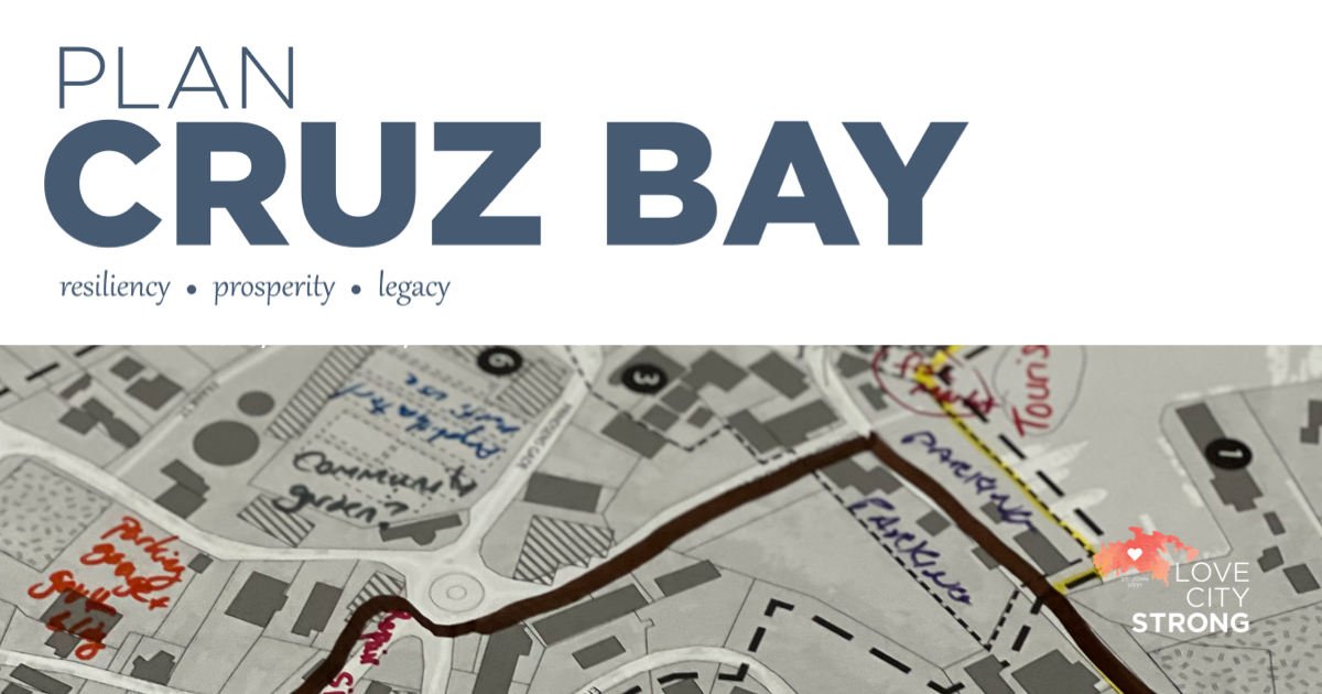
On Monday evening, June 12th, Love City Strong hosted a Plan Cruz Bay hands-on planning session in the cafeteria at Julius E. Sprauve School. For those of you who were unable to join us for this event, here is the link to the recording.
Plan Cruz Bay – Hands On Session – June 12, 2023
If you have questions or input you would like to share, please reach out to our Executive Director Meaghan Enright – meaghan@lovecitystrongvi.org
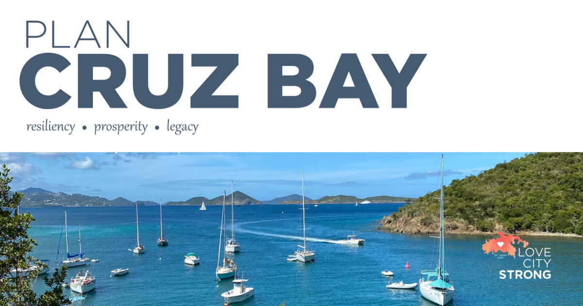
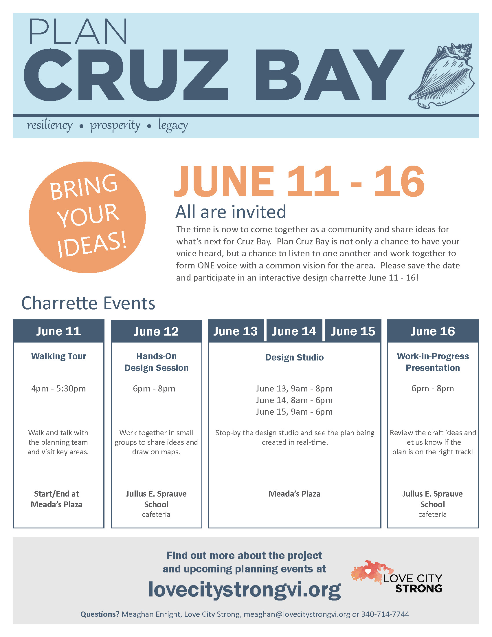
From June 11th to 16th, Love City Strong is hosting an opportunity for the St. John community to come together and share ideas for the future of Cruz Bay. Plan Cruz Bay is a chance to have your voice heard, listen to others, and work together to form a common vision for the area. With a plan in place that reflects the community’s wants and needs, near and long-term development and reuse of property can continue to support a resilient Cruz Bay.
The goal of Plan Cruz Bay is to generate a dynamic near and long-term strategy that includes a conceptual urban design plan to guide future growth and development. The plan will, based on community input, address opportunities and challenges and aim to improve connectivity, pedestrian safety, civic spaces, building form and appearance, and more. The plan will include analysis, before-and-after visualizations, and an implementation strategy. Plan Cruz Bay recommendations will include proposals for housing, transportation, community facilities, stormwater management, and land use. Ideally, the Plan will serve as a guiding document to define residents’ future vision of the area, inform government decisions, and guide implementation actions.
Plan Cruz Bay is sponsored by Love City Strong to amplify the community’s voice and produce a framework for a more resilient future. The recommendations for this Plan will supplement the territory-wide Comprehensive Land & Water Use Plan (CLWUP) that is currently underway, and will take into account other existing and relevant plans in the Territory.
Community involvement is critical to the success of Plan Cruz Bay. The charrette will feature a variety of events on different days and at different times, offering multiple opportunities for residents to participate in the planning process. We encourage you to come to at least one event, if not more. The team leading this important planning effort is made up of recognized local and national experts in the fields of town planning, preservation, and sustainability. All are familiar with the unique conditions of St. John and respect and recognize the value of community. The team has successfully worked on plans in the territories and are currently working together on the territory-wide Comprehensive Land & Water Use Plan (CLWUP). The team is ready to listen and learn, build relationships, and help the community build the best plan forward for Cruz Bay.
The charrette for Cruz Bay will take place June 11 – 16, 2023. During this time, the planning team will set up a design studio in town and host a series of interactive workshops, meetings, and planning sessions. By working on-site, this important plan will be created in real time, in public, with continuous opportunities to share and gather community input.
After the charrette, the planning team will return to their home offices to refine the plans, visualizations, and produce a draft plan document. Updates to the project website and communication from Love City Strong will continue to ensure that the plans and corresponding visualizations and policy recommendations meet the goals of the community. The plan will help inform the territory-wide Comprehensive Land & Water Use Plan (CLWUP) as well as government decisions on the direction of development of public lands. Once the draft plan from the charrette is refined, the planning team will return to St. John and present plan recommendations.
We hope you’ll join us for this exciting opportunity to shape the future of Cruz Bay, address the most pressing needs of St. John residents, and establish a lasting legacy for generations to come.
If you have questions or feedback, please reach out to Love City Strong Executive Director Meaghan Enright via email, meaghan@lovecitystrongvi.org, or during office hours at Suite 102 in The Marketplace.
2023 Forecast
In April, Colorado State University released their first long range forecast for the 2023 Atlantic Hurricane Season. According to the research team, this season could be slightly below average due to El Niño conditions in the Pacific Ocean. Their projections are for 13 named storms, including 6 hurricanes, 2 of which they expect to be major (Category 3 or higher) storms. These numbers are slightly below the 1991 to 2020 average per year. You may be saying, below average? Great news! However, as we all know, it only takes one storm to create significant damage in our community. Even a below average season can produce above average damage for an island or region. In order to plan proactively and be prepared in the event of a disaster, we must each take a moment to step back and assess our risk, whether at home, at school, at work, or within our communities.What is Risk Assessment?
The United Nations Office for Disaster Risk Reduction defines disaster risk assessment as “a qualitative or quantitative approach to determine the nature and extent of disaster risk by analyzing potential hazards and evaluating existing conditions of exposure and vulnerability that together could harm people, property, services, livelihoods, and the environment on which they depend”. What does that mean for you? Risk assessment on a personal level is the process of taking in all the information you have about a given threat, like a potential hurricane, along with all that you know about your home and your life, and deciding how likely it is that this hazard (the hurricane) will inflict harm. In the context of the 2023 hurricane season forecast, our first inclination might be to feel relief at the prospect of a “slow season”. However, upon examination maybe we remember that we haven’t had the trees on the property trimmed in a while, or that we never did find that one shutter for our bedroom window. Perhaps we recall that our neighbor down the street is still living in a home with a damaged roof, or that a member of our church needs to keep their insulin cold. Understanding the risk for wind damage or for extended power outages can help us to prepare for these needs.Understanding Hazards and Forecasts
We can often become complacent about “small” hurricanes, or “just” tropical storms, but the reality is that these systems are capable of just as much damage. Just last fall, Fiona made landfall in Puerto Rico as a Category 1 storm, but dropped more than 30 inches of rain in two days, triggering catastrophic flooding across the island. We’ve all experienced tropical systems moving through the territory that seem so much more intense than expected, with gusting winds and intense periods of rain. The reality is that these weather patterns are mercurial, subject to change and constant variability. A storm that is headed our way may, to our relief, skirt to our south, and a storm we expected to pass by at a safe distance may make a strong turn and make landfall in the territory. The best course of action is to always be prepared. Internally at Love City Strong, we generally prepare as if a storm will be two categories stronger than forecast. The same approach should be taken for rain forecasts – if we’re expected to get 2 to 4 inches, imagine what the impact would be of 6 to 8 inches, and prepare for that. Over prepared is always best. As we count down until the start of hurricane season on June 1st, it’s important to be proactive and plan ahead. Fire up your generator, check your emergency kit, restock any necessary items. Most importantly, talk about your emergency plans with your family, your neighbors, and your colleagues. The more we normalize conversations about preparedness, the more easily we can support each other in times of crisis.
At Love City Strong, we believe that a community-based approach to preparedness is critical to success in disaster response. Research and first hand experience both show that when we are more prepared as families and neighborhoods, we improve recovery outcomes.
When embraced year-round in an all-hazards context, community preparedness improves the ability of individuals and groups to limit the effects of hazard impacts and manage their resources until help arrives. As residents of island communities, isolated by definition, it is particularly important to lean into individual and community preparedness. Our communities thrive when we develop internal resources, skill sets, and commodities that help jump start response and recovery following a disaster.
According to FEMA, many people who believe themselves “prepared” have really done very little in the way of preparation. In a survey, 40 percent of respondents did not have household plans, and nearly 60 percent did not know their community’s evacuation routes. Perhaps most troubling, while 20 percent of respondents indicated that they had a disability that would affect their capacity to respond to an emergency situation, only 1 in 4 of those reported having made any arrangements specific to that disability to help them stay safe in the event of an emergency.
So where can you begin? Community preparedness has three parts: take personal responsibility, seek out training and skill building opportunities, and connect with your community.
Take Personal Responsibility
You can’t support your neighbors and friends if you are struggling yourself. Make emergency planning for your household and your family a priority. Create an emergency plan, practice it regularly, and make sure that each member of your household is taken into account, including the needs of children and pets. Household preparedness includes building an emergency kit, learning evacuation routes and shelter locations, and planning financially for hazard impacts.
Seek Out Training and Skill Building
In the event of a disaster, you may be the first help on hand for someone. There are many opportunities to build the skills necessary to be helpful in a response, from first aid and CPR to Community Emergency Response Team (CERT) training, to HAM radio operations, and much more. In the US Virgin Islands, if you’re interested in being a medical first responder, each island has a Rescue organization you can volunteer with. For all-hazards training, you can register for CERT through the Virgin Islands Territorial Emergency Management Agency (VITEMA). Another resource is your local Voluntary Organizations Active in Disaster (VOAD), which can connect you with volunteer opportunities.
Connect With Your Community
Knowing your community is key in the aftermath of a disaster. You can start small, by making sure you know your neighbors. Who has medical issues? Who has access and functional needs that might require extra support in an emergency? Connect with your church or your local community organizations to see how you may be able to volunteer. Reach out to your local business community, including Rotary and Chamber of Commerce, to start important conversations about business continuity of operations (a topic for another day!) and emergency planning. One of the most important things after a disaster is making sure resources reach those most in need, and by knowing your community, you can help ensure that happens.
Here in the US Virgin Islands, we are used to the issues that surround hurricane preparedness. What we’ve learned over the past two years as a result of the pandemic, however, is that we can’t anticipate when, what, or where the next crisis will be. The best way to make sure our communities are safer, more resilient, and more prepared, is to start close to home.
For more resources, please visit our website, www.lovecitystrongvi.org